

KA-20251003a#
ec_under mpc melt_layer precip multi marine_scCrew#
Job |
Name |
|---|---|
PI |
Tim Carlsen |
Instrument operator |
Sorin Ghemulet |
Instrument operator |
Robert Oscar David |
EarthCARE target scenarios
Melting layer: Porpoising through melting layer over ocean.
Rain: Precipitating clouds over ocean.
Marine Sc: Vertical profiles including drizzle.
Complex multi-layer scenes: Multiple low cloud decks.
Flight summary
During the research flight on 3rd October 2025, we targeted mixed-phase clouds, and specifically the melting layer between 0.9 and 4.0 km altitude underneath EarthCARE (orbit #7665C). We performed porpoising through the melting layer, covering temperatures between -5°C and +6°C and sampling liquid droplets, ice crystals, drizzle, rain and snow. It was a very complex multi-layer scene, so it was hard to say when we were in cloud and when it was just high humidity soup around us. Thus, we also performed some cloud layer hunting, flying some short straight legs when we caught a cloud layer.
Track#
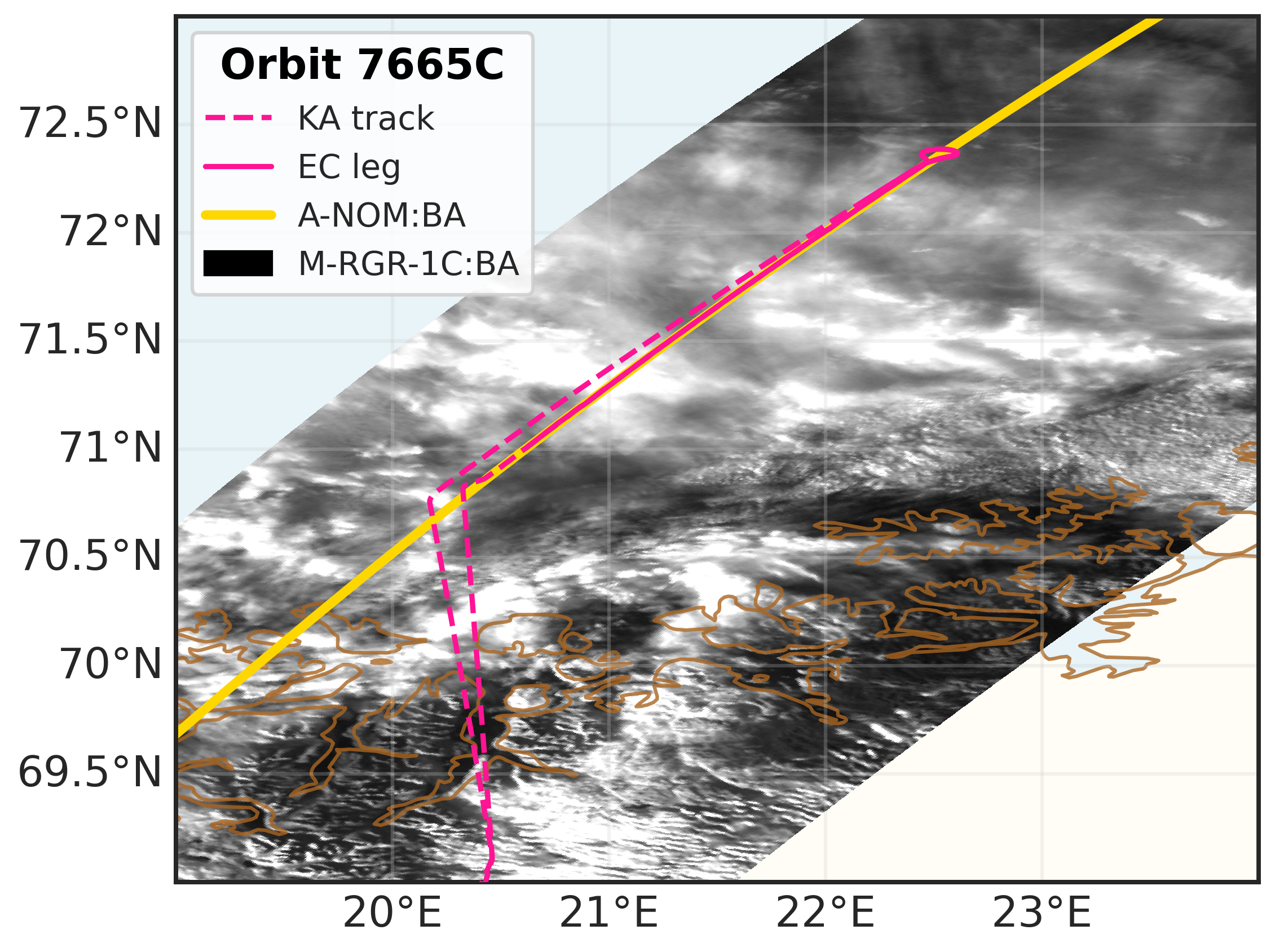
Flight track for KA-20251003a.#
Flight path (dashed line) superimposed on the MSI-RGR-1C product on 3rd October 2025. The ATLID ground track is shown in yellow, while the EC leg (for correlative observations) is shown as a continuous line.
Conditions#
During the EC leg we measured in mixed-phase cloud conditions, sampling liquid droplets, ice crystals, snow and rain. However, it was a very complex multi-layer situation, and we performed porpoising and cloud deck hunting. We porpoised through the melting layer again, sampling in temperatures between -5°C and 6°C.
Flight video#
Video cutting and editing in progress…
Events#
Time (UTC) |
Comment |
|---|---|
12:25 |
Takeoff Kiruna |
13:43 |
Start ec_leg |
13:57 |
EarthCARE overpass (orbit #7665C) |
14:20 |
End ec_leg |
15:21 |
Landing Kiruna |
Execution#
Takeoff KRN: 12:25 UTC (14:25 LT)
slight delay due to printout of flight documents
13:05 UTC: planning to arrive @FL150 @WP1, ETA 13:41 UTC
13:15 UTC: start descent
13:25 UTC: can go max down to FL050 (helicopter in area)
13:34 UTC: descent towards FL150
13:40 UTC: WP1, turn around to go South, going to FL120
13:41 UTC: descent 1000 ft/min, descent towards FL050
13:43 UTC: Start ec_leg
13:46 UTC: WPA
13:57 UTC: start descending again
14:08 UTC: climb towards FL070
14:16 UTC: towards FL130
14:20 UTC: WP2: going home, End ec_leg
14:57 UTC: Instruments stopped (only low clouds ahead), cameras stop
14:58 UTC: data transfer completed
Landing KRN: 15:21 UTC (17:21 LT)
Impressions#
12:31 UTC: Hawkeye up, anti-ice on
12:34 UTC: all cameras on
13:04 UTC: in cloud, FL270, -34°C
13:05 UTC: plates
13:11 UTC: -33°C
13:20 UTC: TAS226, -17°C, FL200
13:21 UTC: TAS222, -15°C, FL190
13:24 UTC: TAS212
13:25 UTC: Bullet rosettes, nothing on FCDP
13:32 UTC: we are in a soup, all cameras go
13:38 UTC: TAS213, -9°C, FL150
13:39 UTC: 2DS-H sees ice, TAS190, -7°C, FL140
13:41 UTC: TAS199
13:43 UTC: TAS194, -3°C, FL110
13:44 UTC: TAS191, -2°C, FL100
13:45 UTC: FCDP sees a bit, a bit in between cloud decks
13:46 UTC: ice on 2DS-H
13:46 UTC: TAS183, 1°C, FL081
13:47 UTC: TAS175
13:48 UTC: TAS173, 2°C, FL061, not much on instruments
13:49 UTC: TAS170, 4°C, FL050, clear below
13:50 UTC: TAS170, 4°C, FL040
13:51 UTC: TAS178, 6°C, FL030
13:53 UTC: TAS174
13:54 UTC: TAS176, 3°C, FL060
13:54 UTC: TAS177, 2°C, FL070
13:56 UTC: TAS185, 0°C, FL090
13:57 UTC: TAS184, -1°C, FL100
13:59 UTC: TAS188, 1°C, FL080
14:00 UTC: TAS181, 3°C, FL060, some particles in FCDP
14:02 UTC: TAS177, 4°C, FL050
14:03 UTC: now in cloud, TAS175, 6°C, FL040
14:04 UTC: back up to FL040 to catch cloud
14:05 UTC: in cloud again, stay at this altitude, TAS186, 6°C, FL037, lots of data now
14:06 UTC: clearing up, climb
14:07 UTC: TAS172, in cloud again
14:08 UTC: TAS170, 5°C, FL050
14:10 UTC: TAS175, 3°C, FL060, ice/snow in 2DS-V
14:11 UTC: out of cloud, climb to FL090, TAS179, 3°C
14:12 UTC: TAS180, 3°C, FL080
14:13 UTC: further up towards FL120, out of cloud again
14:14 UTC: TAS188, 1°C, FL100, a little in FCDP
14:15 UTC: TAS192, -1°C, FL110
14:16 UTC: still out of cloud
14:17 UTC: alt capture, stay here as in cloud, TAS200, -4°C, FL127
14:18 UTC: TAS203, -5°C, FL130, right in cloud again
14:19 UTC: -5°C, FL130, some ice and small droplets
14:20 UTC: cameras worked all the time
14:21 UTC: getting out of cloud
14:21 UTC: some big ice crystals, seeder-feeder
14:24 UTC: big ice falling from above (see photo)
14:28 UTC: still some ice from time to time
14:29 UTC: TAS214, small ice, columns, some bullet rosettes
14:31 UTC: TAS220, -25°C, FL237
14:33 UTC: TAS224, -28°C, FL250
14:35 UTC: TAS225, -28°C, FL250, in cloud
14:36 UTC: lots of ice, TAS222
14:39 UTC: FL250 again ice, TAS225
14:49 UTC: TAS234
14:53 UTC: TAS230, ice from time to time
Instrument status & quicklooks#
Instrument |
Operational |
Comment |
|---|---|---|
FCDP |
✅ |
None |
2D-S |
✅ |
None |
CPI |
❌ |
camera connection issue |
CAS-DPOL |
❌ |
CAPS computer failure |
CIP |
❌ |
CAPS computer failure |
LWC Hotwire |
❌ |
CAPS computer failure |
Gopros |
✅ |
None |
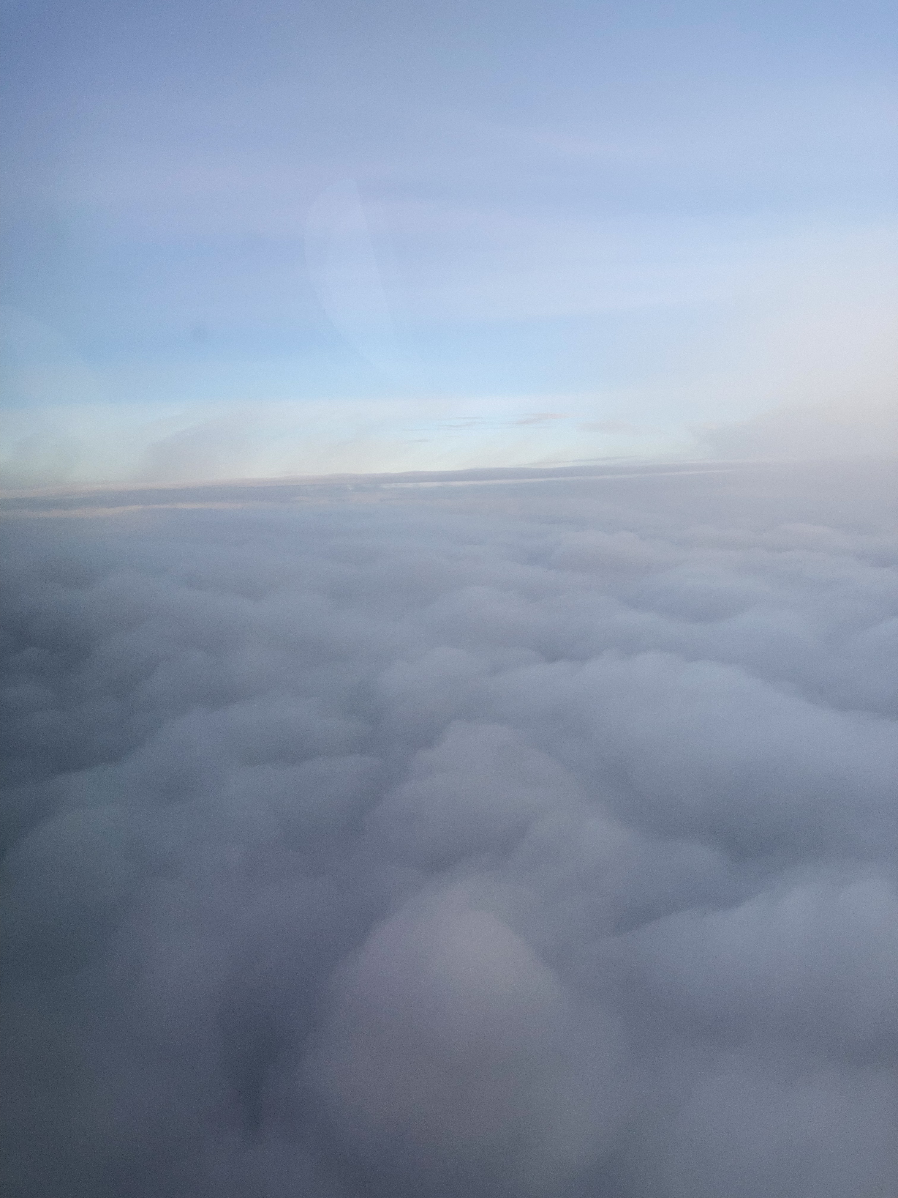
Cloud situation at 14:21 UTC right after the end of the EC leg.
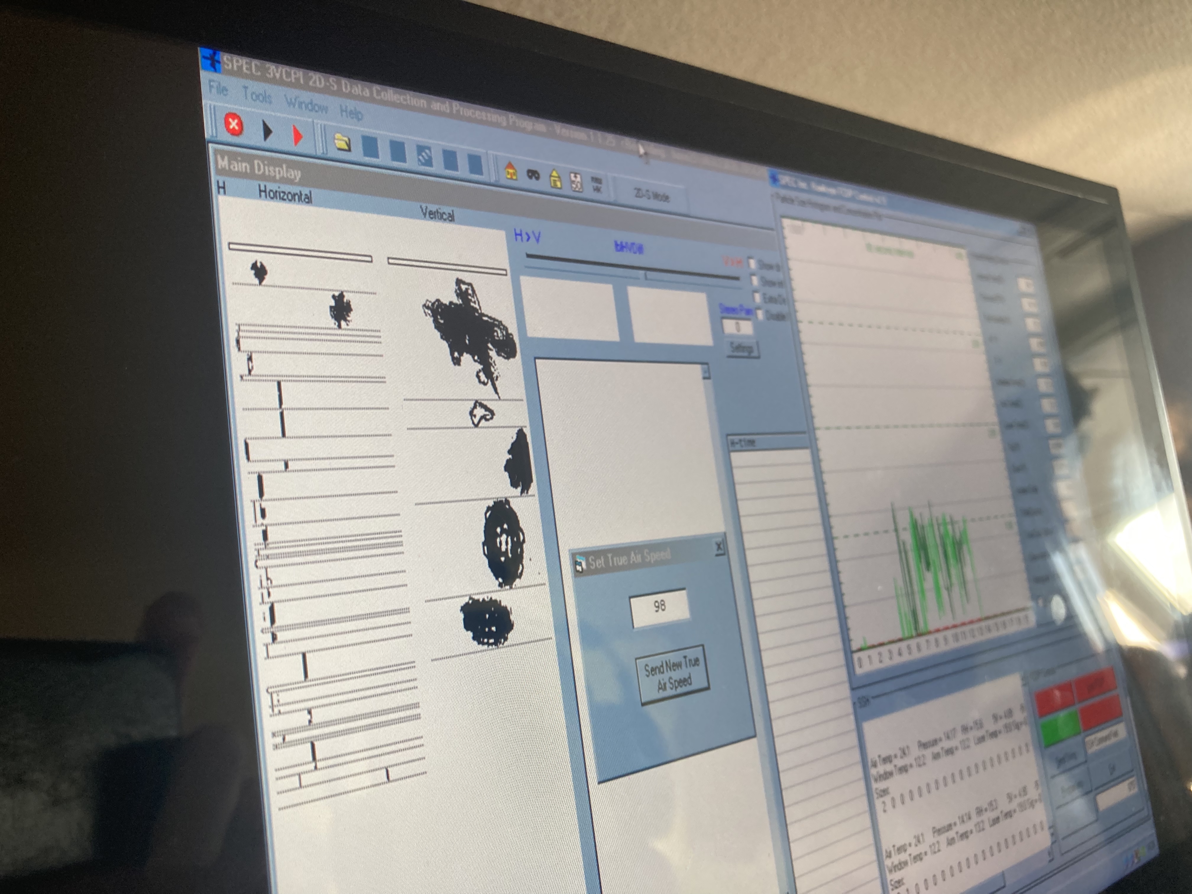
Quicklook live-view of large ice crystal falling from above at 14:24 UTC.